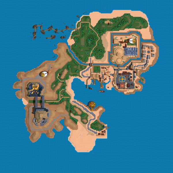
File:RG-map-StrosMKaiSatellite.jpg

Size of this preview: 600 × 600 pixels. Other resolutions: 768 × 768 pixels | 4,096 × 4,096 pixels.
Original file (4,096 × 4,096 pixels, file size: 4.25 MB, MIME type: image/jpeg)
SummaryEdit
A satellite map of Stros M'Kai, uploaded with permission from the creators of Redguard Unity, an engine remake of Redguard.
LicensingEdit
| This file was uploaded to the wiki with permission from the author. |
File history
Click on a date/time to view the file as it appeared at that time.
| Date/Time | Thumbnail | Dimensions | User | Comment | |
|---|---|---|---|---|---|
| current | 22:47, 31 May 2025 | | 4,096 × 4,096 (4.25 MB) | TheRockWithAMedicineCupOnHisHead (talk | contribs) | A satellite map of Stros M'Kai, uploaded with permission from the creators of [https://github.com/RGUnity/redguard-unity ''Redguard Unity''], an engine remake of Redguard. Category:Redguard-Map Images |
- You cannot overwrite this file.
File usage
The following 3 pages link to this file: