| Topal Island | |
|---|---|
| Type | Island |
| Continent | Tamriel |
| Province | Cyrodiil |
| Region | Topal Bay |
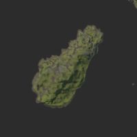
Topal Island is a far-off island region[1] (sometimes depicted as a chain of three islands),[2][3] located in the middle of Topal Bay. The island region is located roughly southeast of Leyawiin and northwest of Soulrest, adjacent to the strip of land around Xi-Tsei that belongs to Cyrodiil. Additionally, the volcanic islet of Grand Topal Hideaway lies off the eastern coast of Topal Island.[4]
The island shares its namesake with Topal Bay, which was named after Topal the Pilot.[5]
HistoryEdit
Sometime after the Empire of Cyrodiil's collapse, Topal Bay pirates terrorized the waters around the island. Voldar, the Terror of Topal Bay, plundered several ships west of Topal Island, and the Blue Wamasu, a notorious band of pirates, would often hang around Topal Island's coast.[6]
By 2E 864, the island was considered a territory of the Elsweyr Confederacy by the Empire.[7] However, by the late Third Era, the Empire considered the isle to be a territory of Cyrodiil.[8][9]
GalleryEdit
NotesEdit
- The island first appeared as an unnamed chain of three islands on the Arena map, not part of any particular province. Later maps depict it is as one large isle in Topal Bay.
- An early name for it was Topal Isle,[UOL 1] and there were once plans to feature it as a battleground in ESO.[UOL 2]
ReferencesEdit
- ^ Field Guide to River Trolls — Phrastus of Elinhir
- ^ a b Arena and Daggerfall map of Tamriel
- ^ a b Arena Deluxe Edition map of Tamriel
- ^ Grand Topal Hideaway in ESO
- ^ Father Of The Niben — Florin Jaliil
- ^ Pirates of Topal Bay — Tarnian Lovidicus, Chief Councilor
- ^ Map from Pocket Guide to the Empire, 1st Edition: The Elsweyr Confederacy — Imperial Geographical Society, 2E 864
- ^ Map of Tamriel – Morrowind Codex
- ^ Map of Tamriel – Oblivion Codex
Note: The following references are considered to be unofficial sources. They are included to round off this article and may not be authoritative or conclusive.
- ^ ESO Writing Team r/elderscrollsonline Ask Us Anything
- ^ ESO Cut Content - Topal Isle maps
